

Estimated reading time: 11 minutes
Air pollution has become a serious concern in urban environments. Rapid development, traffic congestion, and a lack of green spaces contribute to deteriorating urban air quality, which can lead to health risks and accelerated climate change.
Air quality monitoring, when combined with weather APIs like Visual Crossing’s Timeline Weather API, can help urban planners and private entities safeguard public health while advancing environmental initiatives.
Weather data and air quality trends can be invaluable resources for engineering smart city initiatives, regulating air pollution emissions, or optimizing delivery routes for greater efficiency.
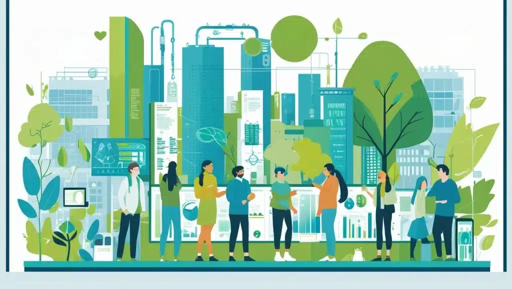
The Intersection of Air Quality, Urban Planning, and Technology

Air quality management is critical to responsible urban development. Urban areas face complex challenges, where interests like tourism, business investment, and public safety must be balanced with environmental regulations. These require data-driven solutions and sustainable, forward-thinking policies.
Combining tools like the air quality index (AQI) with weather APIs, city officials can monitor environmental conditions and forecast potential air pollution trends. They can reduce air pollution, improve public health, and advance their city’s interests through increased quality of life.
By tackling air pollution, cities can improve environmental health and tackle other issues, like socioeconomic disparities, that influence human health. For example, a study by Li et al. in Environmental Research found that Native American communities were more likely to be impacted by major pollutants, including particulate matter (PM). This poor air quality may contribute to disparities in respiratory disease rates and even academic achievement.
Dozens of major cities have already used air quality prediction to improve air quality. For example, Paris, France, has banned highly polluting vehicles from the city center and prioritized walkable neighborhoods. Bogota, Colombia, has created low-emission zones to address pollution from transportation and industrial activities.
Understanding Air Quality Forecasting Models
Air quality forecasting collects data from various sources to create predictive models. These data sources include meteorological data, industrial emissions, traffic flow, vehicle emissions, and geographic information, all of which contribute to air pollution levels.
A variety of predictive models can be used for this process. One of those is multiple linear regression, which considers the impact of different independent variables on air quality. Some variables used include weather conditions, vehicle emissions, and pollution sources.
One example of this technique is particulate matter forecasting. The model considers how multiple pollutants influence the concentration of particulate matter (PM)in the atmosphere. Some common examples of other air pollutants that may interact with PM include carbon monoxide, nitrogen dioxide, ground-level ozone, and sulfur dioxide. The model then combines this with variables like wind speed and temperature. The Environmental Protection Agency (EPA) Air Quality Index (AQI) also uses this model.
Autoregressive Integrated Moving Average (ARIMA) uses historical air quality data to predict the concentration of different air pollutants in the future. This considers how weather, like temperature and precipitation, contributes to poor air quality by assessing how historical highs and lows influence air quality trends.
Lastly, many organizations, including the National Oceanic and Atmospheric Administration (NOAA), are now applying machine learning techniques and artificial intelligence to air quality prediction. These machine learning models, such as support vector regression (SVR), can process thousands of data points much faster than other comparative analysis methods. This allows scientists to develop comprehensive solutions and identify future trends.
How Weather APIs Enhance Forecasting Accuracy
Factors like wind patterns, temperature, and humidity influence the intensity and movement of air pollution in urban environments, meaning that weather APIs are essential for monitoring air quality. For example, high temperatures can increase the concentration of volatile organic compounds (VOCs) because there will be more energy for chemical reactions.
A weather API can provide up-to-date information on environmental conditions, which can then be used to predict air quality. This makes it easier to perform important tasks like traffic management.
Traffic emissions may be a bigger problem on hot, muggy summer days, when particulate matter is stuck floating in the air and nitrogen dioxide is being converted to ozone. City planners can use this information to anticipate when urban air pollution is reaching dangerous levels and make public health advisories. As an example, they may encourage people to stay home, reducing car traffic.
By integrating weather APIs into forecasting models, urban planners have more data to use when planning city operations, which helps them make smart decisions for the greater good.
Data Sources and Model Reliability
Air quality models combine numerous sources to form a comprehensive picture of current environmental conditions, which are then used to build robust models. These sources include government sensor networks, satellite data, and crowd-sourced information like personal weather stations.
Additionally, power plants are required to report their emissions to the EPA, including sulfur dioxide, nitrous oxides, and carbon monoxide. While not tracked on an hourly basis, understanding average industrial emissions can contribute to air quality monitoring.
Having good data is essential to creating predictive models. If a data source isn’t reliable, then the model won’t accurately predict air quality. However, researchers continue to validate and improve models, including training machine learning models with more data. While no model is perfect, they continue to grow more precise over time, offering better predictive power.
Urban Planning Strategies Informed by Forecasting Models
Accurate air quality predictions can help urban planners make critical decisions about design, zoning, and infrastructure planning. These include determining public transportation routes to reduce air pollution, developing green spaces, and separating residential zones from industrial zones. Through smart city air quality optimization and technology-driven insights, planners can improve the quality of life in their jurisdiction.
Zoning and Land Use Decisions
Urban air quality is strongly influenced by infrastructure, such as power generation, industrial plants, public transit, traffic patterns, and population density. A dense urban area may not produce excessive air pollution if there isn’t significant car traffic, but a city with a highway running through it can put public health at risk.
As such, planners should consider environmental factors, including weather patterns and geography, when zoning different areas. In general, a significant portion of any city will be dedicated to commercial and residential space, with industrial zones kept separate. Planners can review air pollution models to understand which areas would be best used for industrial purposes.
While this may seem simple, factors like prevailing winds, municipal water sources, and high-elevation areas must all be considered. For example, planners should not put schools and hospitals downwind of a steel mill, even if that plant is well away from the school.
Incorporating Green Infrastructure
Urban forests, green roofs, and parks are key features of any city, not just for recreational use but also for environmental management. Vegetation helps to absorb pollutants and improve overall air quality while also preventing soil erosion and lowering surface temperatures.
Through insights from air quality predictions, planners can identify where green spaces will have maximum impact. For example, an area near a renewable energy plant might be better for solar panels because there will not be as much air pollution. In contrast, planners may want to plant trees near highways, both to muffle traffic sounds and to absorb pollution.
The Role of Forecasting in Urban Air Pollution Control
City officials must also focus on urban air pollution control. Predictive data can be used to implement short-term interventions, such as temporary traffic restrictions or industry alerts, to reduce emissions when air quality is low. Because individuals and companies will need some time to get alerts and change their plans, forecasting is a key element of good public communication.
Air quality monitoring and forecasting can also help officials improve air quality over the long term by intervening when they identify serious offenders. If there is consistently high nitrogen dioxide near a certain plant, municipal authorities will know they need to enforce environmental regulations through fines or other measures.
Going further, analysis of air quality measurements helps municipal officials understand how certain interventions are working. If the city rolled out an electric vehicle or solar panel tax credit and the air quality index significantly improved, this would demonstrate that there is public buy-in. This way, officials can focus on projects that will provide the greatest public good and budget more effectively.
Emergency Response and Public Safety
While monitoring urban air quality is important at all times, it becomes even more essential during a pollution episode, such as a wildfire or chemical plant explosion. These can cause serious risks to the population, including respiratory failure or cardiac issues.
Data-driven decision-making allows planners to use their resources effectively. Advanced warning through accurate forecasting lets urban planners issue public health alerts, warning those in the pollution zone to evacuate or shelter in place.
Cities can quickly mobilize emergency services, ask for reinforcements from neighboring municipalities, and warn other cities that their citizens may be at risk. In some cases, they may need to reroute public transit or shut it down entirely to discourage people from leaving home.
Applications Beyond Urban Planning: Optimizing Delivery Routes and More

Beyond government projects, urban air quality data is important for businesses, organizations, and the general public. One key benefit is optimizing delivery routes so companies can maintain their efficiency while reducing their operations. Additionally, smart city applications that monitor and manage urban air quality can provide both better data analysis and immediate interventions to improve quality of life.
Logistics and Transportation Efficiency
Transportation companies can use real-time air quality and weather data to plan routes that reduce their environmental footprint. For example, a logistics application can warn drivers about high pollution zones and traffic congestion and suggest an alternative route. This not only improves delivery efficiency but also reduces emissions because idling engines produce more pollutants.
Environmental data has become a key tool for the logistics industry. For example, Amazon uses artificial intelligence to optimize routes and improve fuel efficiency based on current conditions, including key pollution markers and weather events. This gets packages to customers faster by avoiding severe weather, and it also protects delivery workers from issues like hail or high winds. By considering current air quality metrics, logistics companies like Amazon reduce emissions by avoiding congestion and high pollution areas.
Integrating Weather Data with Smart City Technologies
Weather-informed urban air quality management has become a vital element of urban design. By integrating weather and air quality data with the Internet of Things (IoT), cities around the world are advancing urban development while reducing pollution.
Environmental conservation can only work through collaborative and sustained effort. Local governments have joined international networks like Breathe Cities and the C40 Cities initiative, pooling their resources and relying on big data to improve lives.
Modern urban development is interconnected and requires dynamic strategies. With people more mobile than ever before, cities must increasingly show their commitment to initiatives that their citizens care about, including sustainability. Weather and air quality technology is just one of many tools that cities can use to retain citizens, attract investors, and fight climate change.
Challenges and Future Directions for Air Quality Forecasting in Cities
While air quality analysis is very helpful, cities still face significant challenges when it comes to urban air pollution control. Data gaps, model uncertainties, and high costs may make it difficult for smaller municipalities to access the high-quality tools they need to succeed.
Current technology has some limitations, but data scientists continue to innovate through tools like artificial intelligence, machine learning, and the Internet of Things. These will improve forecasting accuracy and allow even more stakeholders to utilize high-quality weather data.
Weather APIs are becoming increasingly important to developing smart cities, especially as models continue to encompass more data points. Due to the interconnectedness of local and regional governments, this weather data helps municipalities plan for regional projects while sharing resources for the greater benefit.
Overcoming Data and Technological Challenges
Air quality research and monitoring have had a huge impact on environmental protection throughout the United States and the world. While current models are highly accurate, they are not without their issues.
Cities may struggle to budget for continuous sensor networks, especially when they have more immediate needs like infrastructure repairs. This leads to gaps in the collected data, which makes predictive analysis harder. Companies are working on reducing sensor costs, while cities are leveraging advanced computational analysis to fill in data gaps without sacrificing accuracy.
Developing an integrated forecasting tool that combines air quality information with weather forecasting can be difficult, as most APIs do not provide both. However, interpolative models can help harmonize the data and create averages between discrepancies to offer more valuable insights.
Future Innovations and Their Impact
The future looks bright for air quality analysis, weather forecasting, and urban management. Continued advancements in weather APIs and sensor technology produce more accurate data, while big data analytics improve the predictive powers of current models.
In the future, integrated platforms will let cities analyze hundreds of variables at once. These include urban conditions, environmental data, and weather conditions, all of which contribute to the overall quality of life and safety in an urban environment.
Combining this with fast and efficient data analysis lets planners harness the power of advanced computational models to make immediate decisions about air pollution and safety. Such integrated dashboards can make for responsive, resilient, and sustainable cities.
While technology is advancing quickly, regulatory change is a bit slower. Municipal governments are often the laboratory for wider legislative improvements, meaning that they can take charge within their jurisdictions and test new technologies. When city governments work together across their region, they can demonstrate the effectiveness of their approaches and then present this information to state and federal governments.
Conclusion: Driving Healthier Cities Through Data-Driven Urban Planning
Quality forecasting from weather APIs like Visual Crossing’s Timeline Weather API is a vital tool for governments. These APIs improve air pollution monitoring and support wider initiatives like optimizing delivery routes, developing smart city solutions, and enhancing climate resilience.
High-quality data enhances decision-making, creating more sustainable and healthier urban environments. Exploring these technological innovations gives public officials the opportunity to be at the cutting edge of urban development while improving health and safety.