

Our 15-day weather forecast is a blended forecast of many of the world’s leading weather models including ECMWF, GFS, ICON and more. We use these models along with real time observations and post-processing to create a forecast for the whole world.
Numerical Weather Prediction
Our forecast data uses numerical weather predication to create a forecast. Numerical weather prediction (NWP) is a form of weather forecasting that uses the fundamental scientific equations that govern the flow of fluids. The models are based on the physics and chemistry of the atmosphere (and their interaction with the ocean and land masses). These equations include many classical equations such as Newton’s laws of motion, conservation of energy and the ideal gas law. The first step of any NWP is to measure the current state of the atmosphere as accurately as possible. This is done by using current measurements from weather stations, radar, and satellite. Using this initial state, calculations are performed to predict how the fluid atmosphere and oceans will behave over time from the initial starting point.
Weather models
Weather models are implementations of numerical weather predictions. Models are computer processes that start with the current state of the atmosphere and use that information to calculate how the atmosphere will change over coming hours and days based on the equations that govern fluids.
Accurately representing the current state of the atmosphere is fundamental to applying the physical and chemical simulations in the computer model to create an accurate prediction. The current state is fed into the computer model from many different types of weather sources. Observations from weather stations and instruments on the ground, sea and in the air are used; as are remote measurements from satellites and weather radar.
A computer model then divides the atmosphere into cells where the initial condition of each cell is set from the observations fed into the model. These cells are arranged in three-dimensional grids. The grids span both the geographical area of the model on the ground but also vertically into the atmosphere. Understanding how the atmosphere behaves above the ground is critical to understanding the weather on the ground. The computer model then steps forwards through time from the initial state and calculates the changes in each cell as they interact with each other over hours and days.
As the size of the cells is reduced, the accuracy of the model forecast is increased. Therefore, a model which consists of smaller cells will be more accurate for a longer period than one with larger cells. However, the more cells in the model, the more powerful the computer must be to process it. Many of the leading weather forecast models are run on some of the world’s most powerful super computers.
Leading global weather models include the United States National Weather Service’s Global Forecast System (GFS), the European Center for Medium-Range Weather Forecast (ECMWF) model, and the DWD ICON models. The most powerful models are global models that require many cells within their model matrix span the entire atmosphere. The accuracy of the weather forecast can be improved by also running global models in combination with regional models that focus on smaller geographical areas. These local models use smaller cells and a limited forecast period to reduce the necessary computing power. These limitations allow the models to be much more accurate for the smaller geographical region and timeframe. For example, localized models are available for the United States, Canada, Europe, and Australia.
As we have seen, the accuracy of the model relies heavily on the initial conditions, the computer algorithms used to represent the atmosphere, and the computing power available to process the model. Differences in any of these factors lead to differences in the weather forecast generated by these models.
Ensemble models
Many models run the same model multiple times with slightly different initial conditions. These are referred to as ensemble models. Ensemble models help identify the uncertainty associated with model calculation or the initial observations. For example, many of the initial model cells will be in the middle of the ocean or be in very remote locations. By running the model with slight variations, the stability of the model can be determined. If the forecast remains the same even with different initial conditions, then the forecast is stable. However, if small changes result in large differences in the forecast, there can be less confidence in the forecast.
In addition to helping to measure confidence in the forecast, the ensemble models also allow the calculation of probability-based weather elements such as ‘chance of precipitation’.
The Visual Crossing Weather Forecast
The Visual Crossing Weather forecast is created by blending many local, regional, and global weather models. By combining models, we ensure that we achieve the highest degree of accuracy and we can compare models to identify the forecast confidence. When multiple models exist, we favor the results of the regional models as these generally have higher accuracy due to their smaller grid sizes. Once the combined weather forecast dataset has been created from the models, we then run it through a series of post-processing steps. These processes ensure consistency, accuracy, and the most optimal delivery structure so that multi-location weather forecast look ups can be made instantly via the Weather API or data download page.
The multiple models combine to provide up to 15 days of global forecast coverage. In Visual Crossing Weather, this information is available at the hourly and daily level. For forecast periods beyond 7-10 days, the forecast is run at three-hour intervals. We interpolate these intervals into hourly estimates to ensure a consistent hourly dataset for processing by clients.
Many weather element values are included in the weather forecast data including temperature, rainfall, wind, and snowfall. For more information on the elements that are available, please see our weather data documentation.
Using model differences to calculate forecast confidence
The Visual Crossing forecast blends multiple models including standard models and ensemble models. These differences help assign confidence to the weather forecast. When most models agree, the confidence of the weather forecast being correct is high but when the predictions of the models disagree then the confidence drops. In that case, localized models or local weather forecasting knowledge can be used to help make more accurate predictions.
How often is the weather forecast updated?
We are continuously updating the weather forecast with the latest information from input models. Each model itself updates at a set interval – typically every hour, every three hours, or every six hours. The blended Visual Crossing forecast will therefore be updated every hour, three or six hours depending on the location being queried.
The following table illustrates the models being used and their upgrade frequency will be updated per the table below. The list of models is subject to change as we evaluate the input model performance and introduce additional models.
| Region | Source Models | Typical Update Frequency |
| North America | HRRR, NAM, GFS, ECWMF, GDPS, US Blended | Every hour for hours 0-48 Every three hours for hours 48-160 Every six hours for hours 160+ |
| Europe | ICON D2, ICON EU, GFS, GFES, ECWMF, GDPS | Every three hours for hours 0-72 Every six hours for hours 160+ |
| Rest of world | GFS, GFES, ECWMF, GDPS | Every six hours |
How long does it take for new model data to be available?
Models are run at fixed intervals, typically based around UTC time (sometimes referred to as GMT or Z time). For example, models that update every six hours will run at 0000, 0600, 1200, and 1800 UTC. The times represent the starting of the forecast where the first hour (hour zero) is the hour that is populated with actual data from weather stations, satellites etc.
Calculation and deployment of the model typically takes several hours. Most of this time is taken by the computers that are calculating the model. After the model has been created, the data is uploaded by the organization creating the model. Finally, the Visual Crossing deployment system retrieves the data and blends it with the other available models.
This process typically takes 3-5 hours for a global model and about 1-2 hours or less for regional models.
What is the geographical precision of the weather forecast?
Each weather model uses a grid as a basis for the weather forecast calculations. Each grid cell ranges from 2-25km in size. In many models the size is based on a latitude-longitude based grid so actual size will vary with latitude.
Models with smaller grid sizes typically produce a more accurate forecast. Higher resolution models can distinguish finer geographical details such as mountain values vs mountain tops and boundaries between land and water bodies such as coastlines.
The computing resources required to execute a forecast model on a global scale is reduced by increasing the size of the grid cells so models for global locations typically have cells sizes between 10 and 25km.
| Region | Source Models | Typical Update Frequency |
| North America | HRRR, NAM, GFS, GFES, ECWMF, GDPS, US Blended | 2km for forecast hours 0-160 15-25km for hours 160+ |
| Europe | ICON D2, ICON EU, GFS, GFES, ECWMF, GDPS | 2km for hours 0-24, central Europe 6km for hours 0-72 15-25km for hours 72+ |
| Rest of world | GFS, GFES, ECWMF, GDPS | 15-25km |
How many days of forecast are available?
Fifteen days of forecast data is available starting with the current day. Hourly data is available for each of those days. Most models do not calculate hourly forecasts beyond 10 days and so our blending algorithm interpolates the three hour forecast values to hourly forecasts.
How is historical data merged with forecast data?
The Timeline Weather API includes weather forecast data for requests for the next fifteen days starting with the current data. By default, historical hours for the current day within that period will be populated with actual historical observations. For example, if the weather is queried at 2:30pm, the hours from midnight to 2pm will use actual historical observations and hours from 3pm onwards will use forecast data. The daily data summary will summarize both the historical and forecast data. If historical data is not yet available for a recent hour, the most recent forecast data will be used.
If you would like to limit your request to only the forecast data, you can use the include=fcst optional request parameter (see the Weather API documentation).
Note that current conditions are not considered for daily aggregations. This is because it is not possible to complete full QA checks on this data.
How are daily values calculated?
All forecast data is calculated at the hourly level. To create daily forecasts, we aggregate the hourly values based on the hours of the day (midnight to the next midnight local time). From there we calculate the maximum and minimum temperatures, sum of rain and snow etc. Note that not all weather data providers calculate daily values across the calendar day. Some providers calculate across a morning-to-morning model (e.g., 6am-6am the next day). This often results in the minimum temperature being offset by a day because minimums normally occur between midnight and 6am.
Why is the Visual Crossing forecast not matching what I see from websites and other providers?
Different weather forecast provides use different models and logic to create a weather forecast. There will inevitably be some differences between the forecast. There are a number of reasons why there may be differences:
- Our hours that constitute a local calendar “Day” run from 12 Midnight to 12 midnight (0-24 hours) local time. For instance, if it rains at 4am, Visual Crossing will say that there is a likelihood of it raining on that day (e.g., Monday). But for other systems that use 6am-6am that “precipitation” will likely show in the previous days’ forecast (eg., Sunday).
- Our geocoding of your location pinpoints a specific latitude and longitude and that is looked up on the weather models cell structure to find out what forecast is best for you. As an example, if you ask for the forecast for an address in Phoenix, AZ many internet systems will simplify your address to the center of Phoenix or at the airport. It may be much hotter there. A system that geocodes to latitude and longitude may have your location in a more precise cell of the model which produces a different forecast.
- Some forecasts simply vary. Just as often as a “different” forecast is wrong, it can also be correct. Not all models agree… this is why Visual Crossing chooses a blended model to combine models and gives added weight for a regional model bias.
- Small readings – In some cases very small precipitation values can get rounded out of some systems and show no rain whereas more scientific systems will focus on any amount of precipitation. It is important in these cases to report the amounts of precipitation.
Are historical forecasts available?
In addition to forecast data for the next 15 days, we also store our previous forecasts so that users can request the data for a forecast made on a previous date. For example, “what was the 15-day forecast on June 1st for London, England?” For more information, read more about the historical weather forecast.
How accurate are your weather forecasts?
By blending the world’s leading weather forecast models as part of our forecast, we ensure that our forecast is as accurate as possible. We always use the latest version of these models to ensure our forecast skill is improving as the input models improve. Depending on the forecast location, you will receive data from different models including the global models such as the GFS and ECWMF models plus regional models including the ICON models. Regional models will be more skillful in forecasting weather conditions due to their higher forecast accuracy (using smaller model cells). They are also generally updated more frequently and so incorporate actual data more often.
The accuracy of a weather forecast is generally found by analyzing the difference between the forecast value and the actual value that occurred for a weather station. In many cases, the difference is expressed as an absolute mean or root mean square error (RMSE). Both of these techniques measure differences between forecast and observation data, eliminating any calculation problems with negative differences. Therefore if the forecast temperature was 20C, both 18C and 22C would be treated as a 2C error in the error calculation.
Many model providers focus on errors within pressure levels as a basis for error as pressure changes form the basis for most weather. We focus on the errors in the forecast surface temperature to identify the accuracy of our models as it is generally more relatable for our users. Temperature is an excellent base measurement that will include effects due to cloud levels, nighttime, and precipitation impact.
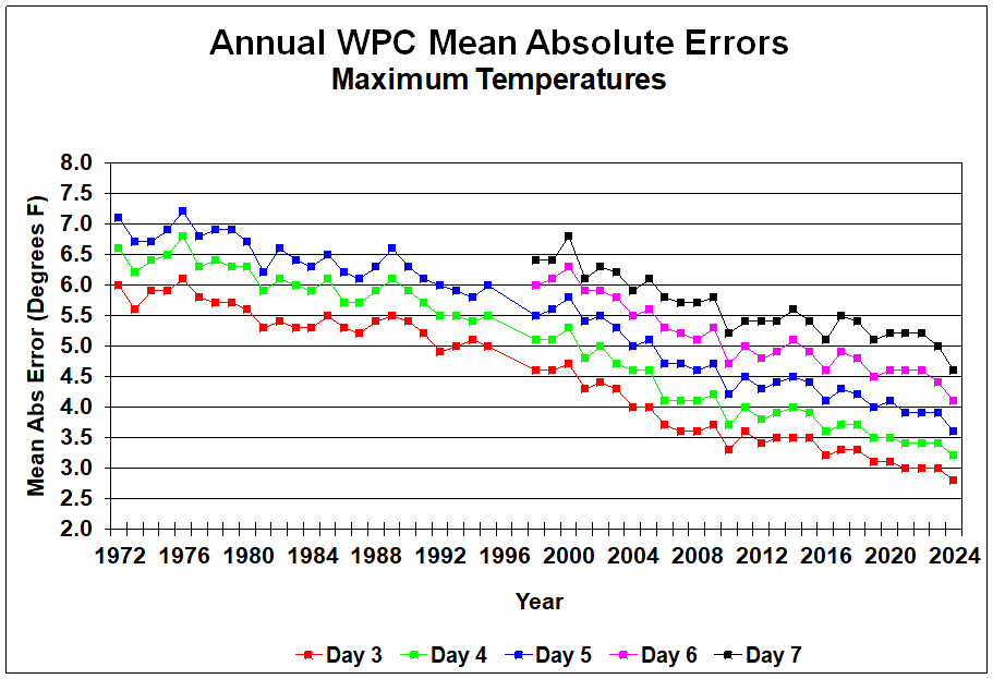
We start our internal error monitoring for the second day of the forecast (day 1 as day 0 is the current day). Our internal measurements indicate a typical forecast error for the temperature to be 1-2C (2-3F) for days two to three. Beyond day three, the error will increase by approximately 0.5C (1F) each day.
NDFD verification data can be found at https://vlab.noaa.gov/web/mdl/ndfd-verification. This indicates that the typical five-day forecast maximum temperature error was approximately 2.5C (4F) when the analysis was last published in 2019.
ICON model verification information can be found at https://www.dwd.de/EN/research/weatherforecasting/num_modelling/05_verification/verification_node.html
The ICON model mean absolute error is currently calculated to be approximately 2C (3.5F) for the three-day forecast, increasing to 3.5C (6F) for forecast day seven.
The GFS model maintains verification data to monitor the skill of the forecast compared to other models and actual observations. The three-day daily maximum temperature error for the GFS is currently less than 2C (3.5F). The mean error increases by 0.3C (0.5F) for each additional forecast day.
The ECMWF model verification and quality monitoring can be found at https://www.ecmwf.int/en/forecasts/quality-our-forecasts
Questions or need help?
If you have a question or need help, please post on our actively monitored forum for the fastest replies. You can also contact our Support Team.