

Violent storms whipped through the D.C. area on Saturday afternoon and evening, leaving residents with the most severe weather conditions in over a decade. Scorching heat, oppressive humidity, a potent cold front, and an energetic disturbance in the upper atmosphere caused these explosive events.
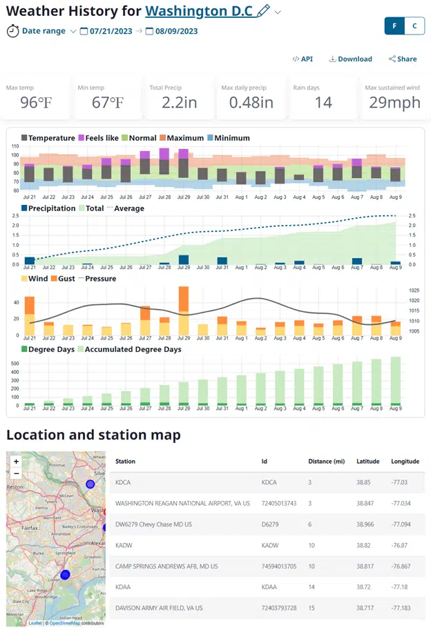
Severe storms cause widespread damage and power outages. Powerful storms with wind speeds exceeding 80 mph wreaked havoc across the region. These stormy conditions resulted in a series of destructive events, including trees falling onto buildings and cars, chimney damage, the peeling off of roofs, and widespread power outages affecting over 200,000 customers.
Once standing tall and proud, trees succumbed to the relentless power of the storms, crashing down upon unsuspecting structures and vehicles. The impact was not limited to the natural environment, as chimneys were forcefully dislodged from their homes, posing a significant threat to nearby structures.
The storms also left a trail of destruction in their wake, as signs that once adorned the streets were mercilessly torn down. Additionally, roofs were stripped away from buildings, leaving the interiors exposed to the elements. Arlington and Northwest Washington, two regions grappling with the aftermath of a severe weather event, were identified as the areas most severely impacted. Thousands of residents in these sections are enduring power outages and clean-up challenges.
Meteorologists have now identified the source of this powerful gust as a meteorological phenomenon commonly referred to as “downbursts.” Downbursts, characterized by a sudden and intense rush of air toward the ground, can unleash significant energy, resulting in strong and potentially damaging winds.
In a recent statement, Dildine, an expert in road safety, has highlighted the various hazards that threaten drivers. Among these dangers, road spray has been identified as a significant concern.
In a recent statement, meteorologists predicted that the ongoing storms would subside after midnight. This news brings hope to those affected by the inclement weather as they eagerly await the conclusion of this turbulent period. Their expertise in weather forecasting lends credibility to this forecast, instilling confidence in the accuracy of the prediction. As the clock ticks closer to midnight, individuals and communities are advised to remain cautious.
In a recent announcement, Reagan National, BWI Marshall, and Dulles International Airports were subject to ground stops on Friday afternoon. However, the good news is that these restrictions were lifted in the evening, relieving travelers.
Fairfax and Loudon counties in Virginia were placed under a Flash Flood Warning by the National Weather Service, which remained in effect until 9 p.m. The warning was issued due to the potential risk of flash flooding in these areas.

Residents of Gaithersburg, Germantown, and North Potomac in Maryland were alerted as a Flash Flood Warning was issued for these areas. The warning, which remained in effect until 8:30 p.m., urged residents to exercise extreme caution and take necessary precautions to ensure their safety.
Severe Thunderstorm Warning Issued for Maryland and Virginia Counties
In a recent development, the weather service has issued a Severe Thunderstorm Warning for specific areas in Maryland and Virginia.
Also a Severe Thunderstorm Warning has been issued for the District of Columbia and certain areas in Prince George’s County, Maryland, and Arlington and Alexandria counties in Virginia. This warning is set to remain in effect until 7:15 p.m.
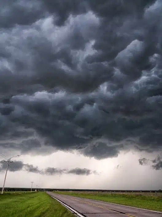
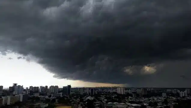
A squall line, characterized by a narrow yet sturdy formation of storms, has emerged in the northern and western suburbs of Washington, D.C. The development of this weather phenomenon correlated with the passage of a high-altitude atmospheric disturbance during the midafternoon. A disturbance has emerged playing a crucial role in atmospheric behavior. This has profoundly impacted the movement of hot air near the Earth’s surface. As a result, the hot air has been propelled upwards, reaching great heights in the sky. This upward travel has allowed the air to cool, leading to condensation and the subsequent formation of magnificent billowing clouds. The consequences of this disturbance are nothing short of extraordinary.
Saturday’s storm wreaked havoc across the region, marking it as the most severe summer weather event thus far. In fact, the areas with the most impact were considered to have the worst storm experience since the notorious derecho that struck in past years. In a stroke of good fortune, weather experts predict that the upcoming workweek will remain free from stormy disturbances.