

Requesting sub-hourly weather data using the Weather API
Sub-hourly historical weather data, or historical weather data with minute-by-minute resolution can be retrieved by users of the weather API. Please see the weather data editions page for details on which weather API plans include sub-hourly data access. Requests for sub-hourly data mirror the same requests for hourly or daily uses however there are some …
Continue reading “Requesting sub-hourly weather data using the Weather API”
Free Weather Tools and Dashboards

One this page you will find a list of our free weather tools and dashboards. These are all accessible without cost and typically without even needing to sign up for a Visual Crossing Weather account. (Of course, we highly recommend that you do sign up as some features are only accessible when logged into our …
Weather Data Documentation
The Visual Crossing Weather Data platform provides the ability to easily access weather data sets including weather forecast data, weather history data and historical weather summary data. The data is available for download through the Weather Data Query Page and the Timeline Weather API. Core weather columns These columns are common to most weather data sets unless disabled. …
Replacing the Yahoo Weather API

Visual Crossing is the perfect replacement for the Yahoo Weather API offering up to 1000 free results a day and full access to forecast and historical data.
How to find historical weather for maritime, sea and ocean locations

Maritime weather data covering many of the world’s oceans and seas is available in Visual Crossing Weather Data Services for viewing, downloading and accessing via the Weather API. This article discusses the available data and the weather elements unique to maritime data. Available maritime weather data Maritime weather data in Visual Crossing Weather is sourced …
Continue reading “How to find historical weather for maritime, sea and ocean locations”
Replacing the Weather Underground API

This article provides a step-by-step guide to replacing the Weather Underground API with the Visual Crossing Timeline Weather API. The Timeline Weather API offers a generous free daily API limit and a simple JSON response that is easily used in any existing application or script. This makes the Timeline API, the perfect replacement for the …
How can I download weather forecast data as a CSV file?
In this article, we will show you how to easily download forecast weather data as a standard CSV file that can be imported into thousands of data analysis and storage applications such as business intelligence systems, visualization tools, statistical analysis packages, and databases. If you would like to download weather history data as a CSV, …
Continue reading “How can I download weather forecast data as a CSV file?”
Replacing the OpenWeatherMap API with Visual Crossing Weather

Visual Crossing is a superior replacement for the OpenWeatherMap API (also known as the OpenWeather API) in both cost and functionality. By offering up to 1000 free results a day and full access to forecast historical data, Visual Crossing Weather makes it easy for everyone to test the API, compare data, evaluate extended weather functionality, …
Continue reading “Replacing the OpenWeatherMap API with Visual Crossing Weather”
How to look up weather by latitude and longitude

The Weather API and Weather Data Services page allows the user to request weather data by a location value. The location value includes the ability to specify latitude and longitude value. This will allow the weather data to be found for any point in the world whether it’s a city with an address or a …
Continue reading “How to look up weather by latitude and longitude”
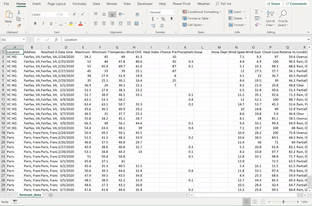
How to download weather forecast data as a Microsoft Excel Workbook
In this article, I’m going to show you how to download weather forecast for any worldwide location data as a standard Microsoft Excel file. Quick Steps to Get Started Now Sign up for a free Visual Crossing Weather account here: https://www.visualcrossing.com/weather/weather-data-services Enter the location(s) for your analysis and select the date or date range that interests …
Continue reading “How to download weather forecast data as a Microsoft Excel Workbook”