

The Visual Crossing Weather API provides access to both historical and future, forecasted weather data. Wherever possible, we use official, physical weather station observations to provide the historical weather data. This ensures that the observations are of the highest quality. However in some cases, such as remote locations away from official weather stations or stations that do not report all weather element types, we are able to supplement the observation weather data with data derived from remote sources, such as as satellites and radar.
What are remote historical weather data sources?
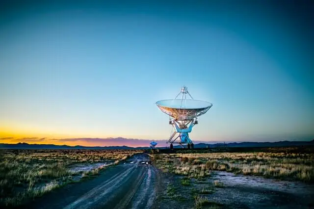
At Visual Crossing, we use the term ‘remote’ observations to generally describe weather observations that we recorded by a device that is physically located apart from the location of interest. The most common examples of remote observations are satellite and radar observations.
Satellite Weather Observations
Circling the globe are a number of weather and climate satellites that are responsible for collecting atmospheric observations from space. These satellites include the GOES series of satellites operated by NASA and the Sentinel satellites operated by the Copernicus Earth Observation program of the European Union. These satellites are designed to record many facets of atmospheric observations such as air flow, sunlight and intensity and temperatures throughout the atmosphere.
By recording the optical properties of the atmosphere, the satellites are able to derive many weather data observations. Some of these are obvious, such as the amount of cloud cover or presence of snow or ice at the surface. In addition the satellites, can analyze for temperature and water vapor and also record the movement of these to understand wind speed and direction.
As the satellites are available from space, they are able to provide complete geographical coverage for the area ‘visible’ to the satellite. This includes coverage in remote land locations, such as a deserts and mountains, and also coverage in the sea, oceans and large lakes.
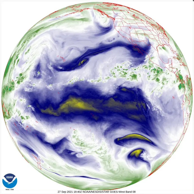
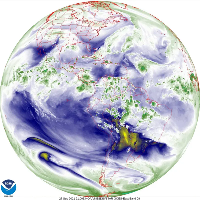
Some weather stations, such as the GOES satellites are considered ‘geo stationary’. These satellites are always located above the same location in the world (they orbit the earth at the same rotational speed as the earth is spinning). They cannot see all over the earth but they are able to provide a continuous picture of the same location. In the case of the GOES satellites, one is focused on the Pacific Ocean and Western United States and another is focused on the Atlantic Ocean and Eastern United States
Radar Weather Observations
Radar observations are typically doppler radar observations primarily made to identify precipitation location, intensity and type. In addition, radar can measure addition weather elements such as relative wind speeds (extremely important for identifying possible tornadoes).
Radar observations are able to provide a nearly complete presentation of precipitation near a weather radar. In mountainous areas, the radar beams can be blocked however and so radar can be less reliable. In addition, radar is less accurate the further away from the radar station that is recorded as the beam spreads out.
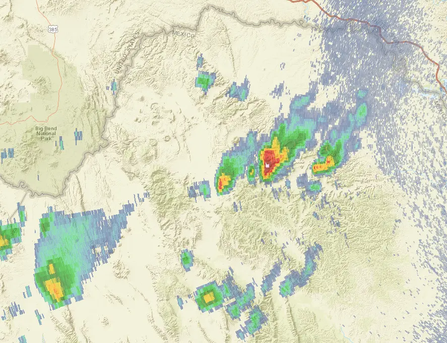
Radar coverage is restricted to certain countries and does not extend into the sea more than one hundred miles.
How Remote Data is used in the Weather API
Remote data can be used to populate data in locations without coverage from on the ground weather stations. This can include maritime and lake locations as satellite and radar sources are not restricted. The data used to create to a complete grid that covers the world by integrating the various remote source of satellite and radar etc. This grids are series of small cells each of which includes the weather that occurred there in the a given hour. The size of cell will vary depending on the location but typically runs between 5 and 50km in size.
Including remote data in a Weather API request
To include observation or remote data into a request, the options parameter is used with the ‘useremote’ and ‘useobs’ options. For example:
https://weather.visualcrossing.com/VisualCrossingWebServices/rest/services/timeline/London,UK/2021-02-15?&key=YOUR_API_KEY&contentType=csv&include=hours&options=useobs,useremote
The options can be used together or separately. If ‘useobs’ is specified by itself, then only weather station observations are considered. This is the same as not specifying either ‘useremote’ or ‘useobs’.
If ‘useremote’ is used by itself, only the remote data is returned. In this case, the data returned will be the value of the weather data in the remote data grid cell that matches the location requested.
If both ‘useobs’ and ‘useremote’ are specified, then the remote data is integrated into the other weather station data using station interpolation. The remote data is treated as a station that is half a grid cell distance from the target location. This accounts for the averaging that has occurred to create the remote data cell representation. A close, high quality weather station is preferred to the remote data. However the remote data is preferably to a distance weather station location.
Using observation and remote data is particularly useful to provide additional weather stations elements that the local weather station does not provide, such as solar radiation data.
The data for data is fully integrated into the result – there is no difference in the output format of the remote and station observation derived data.
Questions or need help?
If you have a question or need help, please post on our actively monitored forum for the fastest replies. You can also contact our Support Team.