

In the United States and other mid-latitude regions, weather systems predominantly move from west to east. This is due to several factors, including the Coriolis effect, jet streams, pressure systems, and global wind circulation. In some areas, topography also plays a role in how weather systems move. Understanding these factors is crucial to understanding how storm systems form and forecasting weather events.

The Coriolis Effect and Atmospheric Movement
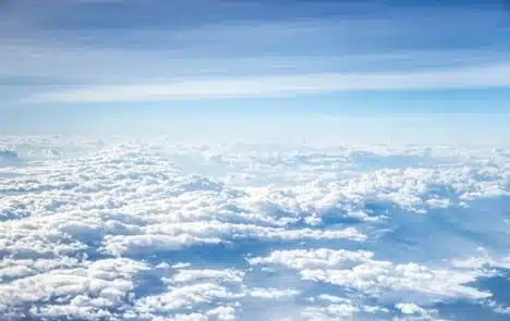
The Coriolis effect refers to the curving path that objects, like clouds or airplanes, will take as they move around the globe, called deflection. Air moves in a certain direction because of this curve.
Due to Earth’s rotation, winds in the Northern Hemisphere tend to move eastward, which causes the general west-to-east movement of weather systems in the United States. Below the equator, in the Southern Hemisphere, weather tends to flow east-to-west instead.
This effect is a foundational factor in the movement of weather systems, and it influences many other elements of why extreme weather events occur.
Jet Streams and Their Influence
Jet streams are fast-moving air currents high in the atmosphere that guide weather systems across the Earth’s surface. Because of the Coriolis effect, jet streams move from west to east in the Northern Hemisphere.
The two main jet streams in the US are the subtropical and polar jet streams. The subtropical jet stream, which is between the equator and the 30-degree latitude, brings moist tropical air northward, where it may interact with the polar jet stream, which carries cold polar air in the mid-latitudes. When this occurs, it may create thunderstorms and other severe weather events.
Jet streams are also responsible for rain patterns, as they carry atmospheric rivers along. These are bands of water vapor drawn from the tropics to the poles. Atmospheric rivers are crucial for bringing moisture to different regions around the world. A notable example in the US is the “Pineapple Express” river, which draws water from around Hawaii up into the Pacific Northwest, like Oregon and Washington State.
Cyclonic Movement
While the entire Earth rotates at the same time, different areas have different velocities. The equator spins faster than the North and South poles. The Coriolis effect is strongest near the equator, which can lead to rotating pressure systems.
High-pressure systems are called anticyclones. Heavy air sinks toward the Earth’s surface and prevents cloud formation. These rotate clockwise and generally bring calm, stable weather. However, those stuck under a high-pressure system may also experience oppressive heat and dry weather.
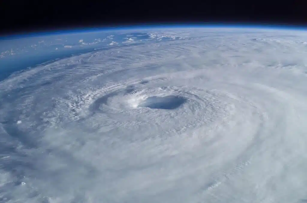
On the other hand, cyclones are created by low-pressure systems. With low air pressure, air masses spiral into the center and are drawn upward. They move in a counterclockwise motion and are blown eastward by the Earth’s rotation.
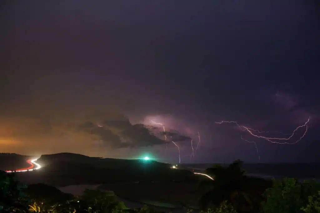
While we generally think of hurricanes when we think of cyclones, many other weather events originate from these air masses. These include heavy rains, sudden temperature drops, and strong winds.
In addition to cyclonic rotations, several other meteorological factors must be present to cause a hurricane. These include warm ocean water, a preexisting disturbance like a thunderstorm, and a stable wind column that is not changing speed or direction, called low wind shear. With low wind shear, the cyclonic rotation will “sit” and pick up more strength from the water, causing the classic hurricane.
The Global Wind Patterns in the Mid-Latitudes
Each hemisphere has three cells that move air: the Polar Cells, the Ferrel Cells, and the Hadley Cells. Each one is responsible for a different type of wind movement, called the prevailing winds.
These winds blow in a particular band of latitude: near the poles, between 60 and 30 degrees latitude, and around the equator. These are just general boundaries, as the winds do not have a fixed position and can move around depending on factors like the Earth’s rotation or atmospheric pressure.
The Polar Cells are the smallest and weakest of the three cells. Cold air around the poles will sink and spread outwards to form a high-pressure system. This causes the polar easterlies, which blow air away from the poles.
Situated around 30 to 60 degrees latitude, the Ferrel cells are sandwiched between the Polar cells and Hadley cells. Air rises around 60 degrees latitude and sinks again at 30 degrees latitude. This circulation system creates the westerlies in the mid-latitudes.
The Hadley Cells move in a circle near the equator, sinking back at around 30 degrees latitude where they meet the westerlies. Warm, moist air rises around the equator, leading to low-pressure systems, and then starts to sink again around the poles. This is called the trade winds.
The prevailing winds do not have distinct boundaries and may interact. Due to the different energy and moisture content of the air in these winds, their interactions can cause storms or other weather patterns.
The United States is in the mid-latitudes, which is where the westerlies prevail. Because of the Coriolis effect, they move from west to east and will therefore cause air to flow toward the east side of the country.
Influence of Topography and Local Effects
While the Coriolis effect, jet streams, and prevailing winds are the dominant causes of west-to-east weather movement, geographical features can also influence weather formation. To understand how topographic features can influence weather, we can break the US up into different sections.
Northeast: The Atlantic Ocean modulates temperatures along the coast, making them warmer in winter and cooler in summer than other areas. Trade winds can sometimes mix in this area and cause major storms.
Southeast: The Southeastern United States, like Florida and Georgia, receives warm, moist air from the Gulf of Mexico, leading to its subtropical climate. These warm air masses have more energy than further north, making a perfect environment for hurricanes. Hurricanes often hit Florida due to its long, flat coastline.
Midwest: Located in the middle of the country, the Great Lakes are a large interconnected body of freshwater lakes. Their large surface size and depth give them a similar, though smaller, effect as the Atlantic or Pacific Oceans. Air near the lakes picks up moisture and leads to large snowstorms in the winter, called lake effect snow.
Great Plains: The Great Plains are typified by very flat terrain. Because there is little to break any wind that blows across, low-pressure systems often spin out of control and turn into severe storms, including the famous tornadoes that Tornado Alley is known for.
Southwest: The Southwest United States is located between the mid-latitude and subtropical circulation regimes, which means that it experiences low precipitation and high temperatures. The low moisture content in soil, when combined with vortex effects from steep cliffs, can cause dust storms.
Rocky Mountains: Due to their high elevation, the Rocky Mountains significantly impact weather systems. Cold, moist air hits the windward side of the Rockies to the west and causes significant precipitation. The east side of the Rockies is a rain shadow, where the mountains block precipitation. These areas will be drier.
Northwest: As mentioned previously, jet streams bring moist air from the South Pacific and up to the Pacific Northwest, leading to this area’s famous misty weather. The Pacific Ocean itself also carries heavy moisture that leads to high precipitation, while polar winds cause colder temperatures than further south.
Within these regions, smaller topographic features may lead to more specific weather patterns. For example, snowfall is not evenly distributed along the Great Lakes. Areas downwind of the lakes, such as Buffalo, NY, can experience very heavy snowfall, while other places, like Chicago, IL, do not get as much.
Seasonal and Regional Variations
Weather systems are not constant, nor are they perfectly predictable. Throughout the year, different patterns determine what kinds of weather a certain area may receive. These can include the following.
Solar Radiation: Different areas of the United States get more or less sun per year. More solar radiation means warmer, moister air, which can lead to large storms.
Jet Stream Patterns: The Earth rotates at a slight angle, which influences the jet streams. They tend to move up or down due to the Coriolis effect combined with the Earth’s tilted axis. In the winter, the polar jet stream may move further south, causing winter storms and lower temperatures.
Temperature Contrasts: When warmer and colder air currents interact, this can lead to volatile weather. One US example is the Intertropical Convergence Zone (ITCZ), where the Northern and Southern trade winds interact around Florida and the Gulf Coast. Their interaction can cause strong storms and other violent weather, or it can lead to something called the doldrums, where there is no air circulation and sailboats cannot move.
Seasonal Shifts: Prevailing winds do not have a fixed position but shift throughout the year, following the sun’s movements. They may also be stronger or weaker at certain times. This leads to distinct precipitation patterns, like the wet and dry seasons seen in tropical areas.
Ocean-Atmospheric Interactions: The ocean and the atmosphere are closely connected. For example, the Northeast typically has cooler summers and slightly warmer winters due to the buffering effect of the Atlantic Ocean, which moderates air temperatures. Ocean currents can also feed cyclones and cause hurricanes, especially when the water is warmer.
Sometimes, multiple factors may come together to create unusual weather patterns, such as Category Five hurricanes that move very slowly. Identifying and predicting these patterns requires statistical analysis and years of experience with similar storm systems.
Conclusion
Weather typically moves from west to east in the United States. This is because the US is in the Northern Hemisphere, and the Coriolis effect pushes wind eastward above the equator. The two major jet streams that impact the US are the subtropical and polar jet streams, which push different air currents across the land. Where they interact, people are more likely to experience severe weather.
Additionally, the US is situated in the mid-latitude westerlies, and these prevailing winds push air from west to east due to how the Earth rotates. However, many other factors may influence how weather patterns form and what people experience on a daily basis. These include seasonal, regional, and geographic factors, such as coastlines and mountain ranges.
Understanding how weather forms is a complex process that relies on high-quality information from sources like Visual Crossing. By analyzing these patterns, meteorologists can predict severe weather events, protect human life, and learn more about the interplay between these different forces.